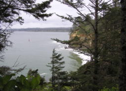
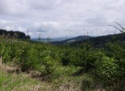
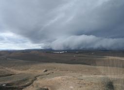
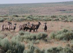
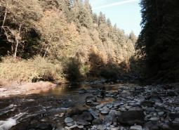
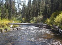
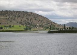
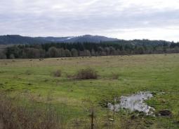
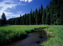
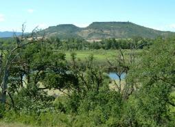
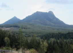
Conservation Opportunity Areas (COAs) are places where broad fish and wildlife conservation goals would best be met. Focusing investments in these prioritized areas can increase the likelihood of long-term success, maximize effectiveness over larger landscapes, improve funding efficiency, and promote cooperative efforts across ownership boundaries.
All 206 COAs include supporting information in an associated COA profile, including details about the area’s Conservation Strategy priorities, recommended actions consistent with local priorities, and ongoing conservation efforts. Access COA profiles by selecting a COA in the map below, or click on one of the icons on the top right hand corner of this page to see a list of all COA profiles.
COAs were developed to guide voluntary conservation actions in Oregon. Land use or other activities within these areas will not be subject to any new regulations. The Oregon Department of Fish and Wildlife (ODFW) COA map, dataset, and underlying profile information should only be used in ways consistent with these intentions.
For more information on what COAs are and how they were developed, see the COA Overview and COA Methodology sections.
To view COAs in a list or grid form, select one of the viewing option icons (next to the map pin) on the top right hand side of the screen.
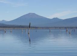
Alkali Lake [COA ID: 190]
Encompassing Alkali Lake, this COA is the smallest in the Northern Basin and Range ecoregion. It is located north of Lake Abert and just west of US Highway 395 in eastern Lake County.
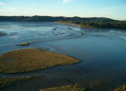
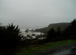
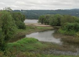
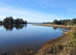
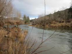
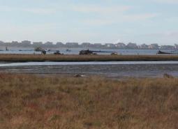
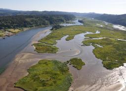
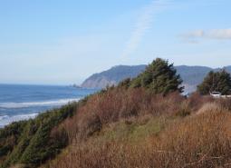
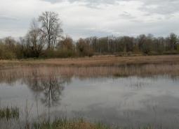
Alsea Estuary-Alsea River [COA ID: 029]
The Alsea Estuary is large and shallow and provides overwintering habitat for migrating waterfowl and rearing habitat for coastal salmonids. The COA also has had extensive salt marsh habitat restoration and contains a lot of public lands.
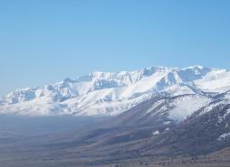
Alvord Lake Basin [COA ID: 194]
The northern extent of this long narrow COA includes Tudor Lake at the eastern base of Steens Mountain. Continuing south and encompassing a large swath of the Alvord Desert, including the seasonal and alkali Alvord Lake, the COA ends just south of the community of Fields in the Pueblo Valley.
Anderson Butte [COA ID: 103]
This area is diverse with open south-facing meadows, oak woodlands, and mature conifers.
Antelope Creek-Paynes Cliffs [COA ID: 099]
This area includes important and rare low eleveation rocky outcropping and cliff habitat as well as Antelope Creek, historically one of the biggest producers of Summer Steelhead in the Rogue Watershed.
Bakeoven Creek-Buckhollow Creek [COA ID: 151]
The northern boundary of this COA follows Buck Hollow Creek, with the remaining boundaries connecting to the Lower Deschutes River (COA ID 148) and Lawrence Grasslands (COA ID 152) COAs.
Baker Valley Wetlands [COA ID: 165]
Located in the Powder River Basin immediately northwest of Baker City and including the town of Haines
Banks Swamp [COA ID: 062]
Also known as Killin Wetlands and Cedar Canyon Marsh, this 590-acre Metro-owned site is located west of Banks in the Tualatin River watershed.
Baskett Butte [COA ID: 072]
Located north of Dallas along Highways 22 and 99W. Upland oak-dominated hills, Basket Slough, Ash Swale, and headwaters of Salt Creek, tributary of South Yamhill River.
Basque Hills Area Plains [COA ID: 202]
Barely crossing into Lake County on its western edge, This COA is predominantly located in southwestern Harney County and connects to the Sage Hen Creek COA (201) and the Hart Mountain Area COA (200) on its western and southeastern borders. It encompasses an area from Mahogany Mountain in the north to the southern edge of …
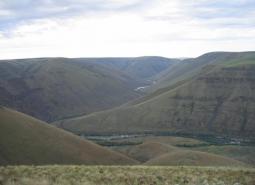
Bear Valley [COA ID: 177]
Located south of John Day, along the Silvies River and including the town of Seneca. Area encompasses important wetland and riparian habitats in the valley.
Beaver Creek [COA ID: 027]
Beaver creek watershed is diverse and productive as habitats start at the beach and move up to the old growth forests.
Big Butte Area [COA ID: 122]
This area is in the foothills of the West Cascades ecoregion and contains important Oak Woodland and Ceanothus Shrubland habitats.
Big Marsh Creek [COA ID: 133]
Area includes river headwaters near Crescent Lake Junction and flows into Oregon Cascades National Recreation Area.
Boardman Area [COA ID: 154]
South of the Columbia River, in north central Oregon. Area includes important conservation lands near the Boardman Conservation Area; Willow Creek Wildlife Area; and grassland included in The Nature Conservancy conservation portfolio

Breitenbush River [COA ID: 110]
Area contains mid to high elevation managed forest and tributaries of the North Santiam River.
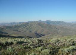
Brothers-North Wagontire [COA ID: 184]
The northern extent of this COA includes the Bear Creek Buttes and Rodman Rim area in the Ochoco Mountain foothills. South of US Highway 20, the COA encompasses Pine Mountain and a large area of sagebrush steppe dotted by numerous buttes north of Christmas Valley. Heading east it covers Elk Mountain and Rams Butte before …
Bull of the Woods, North [COA ID: 108]
Areas is north of the Bull of the Woods Wilderness Area in the Mount Hood National Forest and contains the headwaters of the Clackamas River.
Bull Run-Sandy Rivers [COA ID: 105]
Area includes the headwaters of the Sandy River and its tributaries including the Bull Run River. Much of area is located within the Mt. Hood National Forest.
Bully Creek Area [COA ID: 183]
Adjacent to North Fork Malheur – Monument Rock area, including significant stretches of Clover Creek and Bully Creek
Burnt River [COA ID: 166]
Includes important stretch of the Burnt River and adjacent riparian habitat. Includes the town of Bridgewater.
Calapooia River [COA ID: 082]
The Calapooia River Corridor spans from Albany through Tangent, Brownsville and through the Holley area.
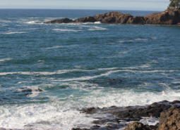
Cape Ferrelo [COA ID: 051]
This area includes unique rocky intertidal habitat, important shorebird habitat, and coastal bluffs.
Central Cascades Crest, Southeast [COA ID: 116]
Directly adjacent to the Upper Deschutes River COA.
Central Cascades Crest, West [COA ID: 113]
Partially bounded by the North Santiam River to the north, the McKenzie River to the west, and the Middle Fork Willamette to the south. Area encompasses significant high-quality fish and wildlife habitat next to wilderness areas managed for their conservation values
Chetco River-Winhchuck River Estuaries [COA ID: 052]
This diverse area includes habitats ranging from coastal dunes and estuaries to mature upland conifer forests.
Chewaucan River [COA ID: 141]
Area includes the Chewaucan River and surrounding habitats
Clackamas River and Tributaries [COA ID: 065]
Area extends from the Willamette River area upstream to Estacada and includes floodplain, tributaries, and upland habitats.
Clatskanie River [COA ID: 008]
The area connects with Columbia – Clatskanie COA and contains the entire Clatskanie River watershed. OWEB has granted Lower Columbia Watershed Council and others to reconnect Westport Slough to the Clatskanie River.
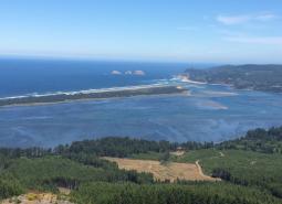
Clatsop Plains [COA ID: 001]
This area which is about 30 square miles, is composed of Gearhart Fen the largest contiguous wetland of its kind remaining on the Oregon coast. The Clatsop Plains beaches provide habitat for shorebirds during migration (e.g. Sanderlings) and potential areas for nesting Western Snowy Plovers. The area is conterminal with Necanicum River, Tillamook Head and …
Clatsop State Forest-Jewel Meadows Area [COA ID: 007]
The area includes Clatsop State Forest and Jewel Meadows Wildlife Area and connects with Columbia River – Blind Slough Swamp. The watershed provides critical habitat for many coastal plant and animal communities. The area contains managed forest including components of mature stands and remnant large trees and open upland grassland meadows.
Coburg Ridge [COA ID: 087]
Ridgeline, foothills, and associated lowlands bordering the east side of the ecoregion from Coburg Ridge to Indian Head
Cold Springs National Wildlife Refuge Area [COA ID: 156]
Just east of Hermiston and extending to include a small stretch of the Columbia River. Includes Cold Springs National Wildlife Refuge
Columbia River-Blind Slough Swamp [COA ID: 006]
This is a an extensive area on the lower Columbia River Estuary from east of Tongue Point upstream to Crims Island. The area encompasses the Julia B. Hanson and Lewis and Clark National Wildlife Refuges and the Blind Slough Swamp Preserve, which contains ancient Sitka spruce trees and is one of the best examples of swamps …
Coos Bay [COA ID: 043]
Encompasses Coos Bay and surrounding habitats. Includes the towns of Coos Bay and North Bend.
Coos Mountain-Middle Creek [COA ID: 044]
Connecting to the Lower Coquille River COA, this area follows Middle Creek northward and includes surrounding riparian and upland habitat
Corvallis Area Forests and Balds [COA ID: 081]
This are spans the Greasy Creek and Marys River Drainages south and west of Philomath, is bordered to the west by Kings Valley, and continues through the hills west and north of of Corvallis and Adair Village through the Maxfield, Berry Creek and Soap Creek Drainages at the southerly boundary of Polk County.
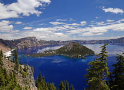
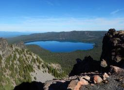
Crater Lake [COA ID: 121]
Crater Lake, Crater Lake National Park and surrounding wetlands and forest habitats.
Crawfordsville Oak-Washburn Butte [COA ID: 085]
Area of primarily forested, rolling hills northeast of Brownsville and the Calapooia River, southwest of Sodaville, Lebanon and Sweet Home
Crowley [COA ID: 185]
This rugged COA begins in Harney County near the confluence of Crane Creek and the South Fork Malheur River. Moving north east, the COA crosses into Malheur County and wraps around Swamp Creek Buttes. Continuing north towards Juntura, it then follows an eastward line (south of US Highway 20) towards Namorf. Finally, the COA heads …
Deer Island [COA ID: 053]
A large (3,000+ acres) island located at River Mile 78-81 along the Lower Columbia River.
Depoe Bay Area [COA ID: 023]
The Depoe Bay COA contains the world’s smallest harbor and has a productive rocky shore and headlands for fish and wildlife use.
Deschutes River [COA ID: 149]
Mainly located on the Warms Springs Reservation, this narrow COA includes a section of the Deschutes River from above the confluence with the Warms Springs River, north to approximately 1.5 miles below White Horse Rapids. From east to west the COA runs from the east side of the Deschutes River, adjacent to White Horse rapids, …
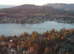
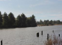
Devil’s Lake [COA ID: 020]
Rock Creek which flows into Devil’s Lake is one of the most important Coho producing streams on the coast. Rock Creek mouth is a peat marsh of several acres in size.
Dry Valley [COA ID: 144]
Area includes important stretches of Dry Creek, Drews Creek and Dog Lake
Dundee Oaks [COA ID: 066]
Area is also known as the Red Hills Conservation Area. Includes the Red Hills of Dundee, which separate the Chehalem Valley from the Yamhill River basin and headwater tributaries of the Yamhill River.
East Fork Illinois River [COA ID: 101]
This area includes important riparian habitat in the East Fork Illinios River and Sucker Creek for Coho Salmon and Pacific Lamprey.
East Madras-Trout Creek Sagebrush and Grassland Area [COA ID: 172]
Adjacent to Lower John Day COA, just east of the town of Madras.
Elliot State Forest [COA ID: 041]
Located immediately adjacent to Tenmile Lakes COA, this area is located inland east from the town of Lakeside. Bounded by Highway 38 and the Umpqua River to the north.
Eola Hills [COA ID: 073]
Area is located west of Salem and includes tributaries of the South Yamhill River, Willamette River, and Rickreall Creek.
Fields Peak [COA ID: 176]
Just north of Bear Valley COA and east of the South John day River COA
Fifteenmile Creek [COA ID: 147]
Area just east of The Dalles Airport, following Fifteen Mile Creek, and extending north to the Oregon/Washington border along the Columbia River.
Finley-Muddy Creek Area [COA ID: 084]
Located around Finley Wildlife Refuge south of Corvallis along the west side of Hwy 99; area extends up Muddy Creek west of Monroe to its confluence with Marys River
Forest Park [COA ID: 058]
This area in the Tualatin Mountains (Portland’s West Hills) includes the City of Portland’s 5,172-acre Forest Park.
Foster Flat-Black Rim Sagebrush Area [COA ID: 191]
Located in the Foster Flat area, south of Harney Lake and west of US Highway 205, this COA encompasses large areas of sagebrush steppe shrublands and scattered wetlands.
Gales Creek [COA ID: 013]
The area is a late successional mixed deciduous and conifer forest with wetlands, flowing water and riparian habitats in the Gales Creek watershed. The 46 square mile area is conterminal with Nehalem and Salmonberry River Headwaters and Tillamook Bay and Tributaries COAs.
Gearhart Mountain-North Fork Sprague [COA ID: 140]
Includes the North Fork Sprague river and its surrounding habitat; includes the area surrounding Gearhart Wilderness Area
Grande Ronde Valley [COA ID: 159]
This COA encompasses the Ladd Marsh Wildlife Area and a buffered area adjacent to the Grande Ronde River from La Grande to several miles below Elgin.
Grave Creek [COA ID: 094]
Area connects the Rogue River and King Mountain COAs, following Grave Creek and its surrounding habitat. Located just north of the town of Merlin
Habeck Oaks [COA ID: 074]
An area of primarily privately-owned mixed farmland and forest located north of the Little Luckiamute River along Hwy 223 between Dallas and Falls City
Harney-Malheur Area [COA ID: 187]
This COA encompasses both Harney and Malheur Lakes at the north end and then heads south along the Donner and Blitzen River and Blitzen Valley. An eastern finger of the COA continues out of the valley as far as the town of Diamond and the southern finger ends near French Glen.
Hart Mountain Area [COA ID: 200]
Mainly located in south eastern Lake County, this COA encompasses an area from the Oregon/Nevada border in the south; Coleman Valley and Warner Valley in the west; Guano Valley and Mahogany Butte in the east, and across to the southeastern corner of Hart Mountain National Antelope Refuge in the north. The COA includes several protected …
Hayden Island-Government Island [COA ID: 055]
Columbia River islands comprised of 826-acre West Hayden Island located north of the City of Portland just outside city limits and the Government Island complex located between River Mile 111 and 119. The complex includes Lemon and McGuire Islands and total about 2,225 acres.
Heceta Head [COA ID: 031]
A coastal headland with nearby steller sea lion haulouts. A large portion of the Siuslaw National Forest is included.
Hood River [COA ID: 106]
Area includes Hood River mainstem, East and Middle Fork and numerous tributaries from confluence with Columbia River upstream. and
Illinois River-Silver Creek [COA ID: 096]
This large and diverse COA includes mature conifer forests as well as dense manzanita and Ceanothus brush fields created by the 2002 biscuit fire, which burned 500,000 acres in the Siskiyou National Forest. The COA contains serpentine soils that are home to the rare and endemic plant that make the Klamath Mountain Ecoregion an area …
Imnaha [COA ID: 161]
Follows canyons along the Snake River from Hwy 86 north to the ecoregion boundary
Jordan Creek Wetlands [COA ID: 195]
Located in east-central Malheur County, this small COA encompasses Jorden Valley and the surrounding hills, from the Oregon/Idaho border west into Jordan Creek Canyon.
Kalmiopsis Area [COA ID: 100]
This areas borders the western edge of the Kalmiopsis Wilderness and has unique plant communities due to the serpentine soils endemic to the Klamath Mountains ecoregion.
King Mountain Area [COA ID: 095]
This area contains federal lands intermixed with private ownership in a checkerboard matrix. Habitat is diverse inlcuding mature conifer forests, open early seral habitat created by logging, and oak woodlands. The area may serve as a possible movement corridor connecting the introduced southern Cascade Pacific Fisher population to the native Northern California/Southern Oregon population.
Kings Valley-Woods Creek Oak Woodlands [COA ID: 080]
This corridor in Benton County extends from the south end of Woods Creek Rd. through the town of Wren, along Kings Valley Highway, to the Polk County line
Kingston Prairie-Scio Oak Pine Savanna [COA ID: 079]
The area northeast of Scio south of the North Santiam River and north of Thomas Creek
Klamath Marsh-Williamson River [COA ID: 134]
Large natural marsh with adjacent Ponderosa Pine forest habitat. Williamson River area spans Klamath Marsh National Wildlife Refuge and Sycan Marsh.
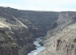
Klamath River Canyon [COA ID: 142]
Area follows the Klamath River to the California border
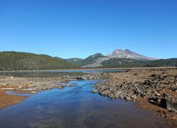
Lake Abert [COA ID: 197]
Located in central Lake County, this COA encompasses Lake Abert, including the Lake Abert Area of Critical Environmental Concern and portions of the Abert Rim Wilderness Study Area.
Lawrence Grasslands [COA ID: 152]
In the southwest corner of the ecoregion just west of Antelope.
Little Deschutes River [COA ID: 132]
Area includes the Little Deschutes River, a tributary of the Deschutes River. The Little Deschutes drains a rural area on the eastside of the Cascade Range.
Little Louse Canyon [COA ID: 205]
Located in Southeastern Malheur County, this western extent of this COA includes High Peak and Battle Mountain; the eastern edge is found close to Louse Creek; its northern extent is approximately five miles north of Big Antelope Creek – before its confluence with the Owyhee River; and the southern border includes the upper reaches of Big Antelope …
Little North Santiam River Area [COA ID: 109]
Area includes headwaters of North Santiam and Pudding Rivers, comprised largely of National Forest lands, private industrial forest and state-owned recreational areas.
Logan Valley-John Day River Headwaters [COA ID: 179]
Area just west of John Day and including the town of Prairie. Area encompasses the John Day River headwaters and a variety of diverse Strategy Habitats
Long Creek-Coyote Creek-Silver Creek [COA ID: 135]
Area comprised of three major sub-watersheds immediately adjacent to Sycan Marsh, including river confluence.
Lost River Area [COA ID: 143]
Includes the Lost River Basin and surrounding native habitats
Lower Coquille River [COA ID: 045]
Follows the Lower Coquille River from its mouth at the Oregon coast and extending east to Highway 42 (past the Benham Airport)
Lower Deschutes River [COA ID: 148]
Follows the Lower Deschutes River Corridor and includes surrounding habitat.
Lower Grande Ronde [COA ID: 158]
This COA follows the Grande Ronde River from the Oregon/Washington border to its confluence with the Wallowa River, then continues up the Wallowa to Highway 82 and the Minam River confluence. It includes many of the smaller tributaries and significant portions of larger tributaries.
Lower John Day River [COA ID: 153]
Area follows the lower John Day River and surrounding habitats.
Lower Rogue River and Estuary [COA ID: 049]
This are contains the mouth of the Rogue River and is important habitat for Salmonids accessing the rest of the system. It has mature upland forests with a productive hardwood understory that supports a diverse assemblage of wildlife species.
Lower Sandy River [COA ID: 057]
This area is comprised of the 1,500-acre Sandy River Delta at the confluence of the Sandy and Columbia Rivers, plus the Lower Sandy River and its tributaries, including Beaver Creek and the lower reaches of the Bull Run River. Located east of the Portland Metro area in the Columbia River Gorge National Scenic Area.
Lower Willamette River Floodplain [COA ID: 059]
The Willamette River mainstem from the confluence with the Columbia River (RM 0) upstream to Willamette Falls in Oregon City (RM26), its floodplain and adjacent uplands.
Luckiamute River and Tributaries [COA ID: 075]
The Luckiamute and Little Luckiamute Rivers and tributary drainages and associated agricultural lands surrounding the Kings Valley Area and South of Falls City.
Malheur River Headwaters [COA ID: 180]
The Malheur River Headwaters COA spans two ecoregions. Within the BM ecoregion, the COA includes Logan Valley and part of the Strawberry Mountain Wilderness and continues south to Battle Mountain (just north of Highway 306). Within the NBR, the COA is comprised of land associated with the Malheur River south of Battle Mountain to approximately …
Mary’s Peak [COA ID: 028]
Covers Mary’s Peak and surrounding wilderness area. Located north of Highway 34 and southwest of Philomath.
McKenzie River Area [COA ID: 114]
Area includes an important stretch of the McKenzie River, beginning just west of Willamette National Forest land and following the McKenzie through the city of Eugene
McTimmons Valley – Airlie Savanna [COA ID: 076]
Twelve square miles of grassland and oak savanna habitat surrounding McTimmonds Creek, north of Pedee
Metolius Bench-Mutton Mountains Wildlife Movement Corridor [COA ID: 150]
This long narrow COA spans two ecoregions. Within the East Cascades, it begins on the south side of the Metolius River, northwest of Lake Billy Chinook, and crosses over the river and into the Warm Springs Reservation. Heading north east, the COA crosses into the Blue Mountains ecoregion, across US Highway 26, and at its …
Metolius River Area [COA ID: 127]
Includes Metolius River basin, includes Green Ridge, and extends to include nearby valleys. Nationally known scenic recreation area that provides high quality habitat for fish and wildlife in Central Oregon.
Middle Fork John Day River [COA ID: 170]
Includes significant stretch of Middle Fork John Day River, Long Creek, and part of the North Fork John Day River.
Middle Fork Willamette River [COA ID: 115]
Follows a significant stretch of the Middle Fork Willamette River and its surrounding riparian and upland habitat, bounded to the west by the town of Dexter and extending east to the Oakridge Airport.
Middle Owyhee River Area [COA ID: 186]
This COA is located in the northeast quarter of Malheur County and abuts the Crowley COA to the west. It encompasses Owyhee Lake and River from just east of Mitchell Butte (near the city of Adrian) south to Greeley Bar. Continuing south and east, the COA includes the rugged landscape of Mahogany Mountain, Jordan Craters, …
Middle Willamette River Floodplain [COA ID: 060]
The mainstem Willamette River from Willamette Falls (RM 26) to the confluence with Calapooia River in Albany (RM 120), plus floodplain, and adjacent uplands.
Middlefork Willamette River Headwaters [COA ID: 118]
Area includes a significant stretch of the Middle Fork Willamette River, from Hills Creek Reservoir to the north and extending east towards Summit Lake and the Diamond Peak Wilderness Area boundary
Mill Creek [COA ID: 024]
Relatively small (15 sq mi) COA at the eastern edge of the Coast Range ecoregion, building from the Red Prairie-Mill Creek – Willamina Oaks COA in the Willamette Valley ecoregion, northwest of the town of Dallas.
Missouri Ridge [COA ID: 070]
Area is located between Scotts Mills and Molalla in the Rock Creek subbasin, a tributary of the Pudding River.
Mohawk River [COA ID: 088]
Relatively small (18 sq mi) COA following the Mohawk River northeast of Eugene
Molalla River [COA ID: 069]
Area comprised of Molalla River from Mulino upstream to the Dickie Prairie area, plus the lower reaches of major tributary Milk Creek.
Mt Hood Area [COA ID: 107]
Area is located within Mount Hood National Forest and includes the headwater streams of Hood, Clackamas, Sandy and White Rivers.
Mt Jefferson Wilderness, North [COA ID: 111]
Area is adjacent to Mount Jefferson Wilderness and includes headwaters of Clackamas, North Santiam and Deschutes Rivers.
Necanicum Estuary [COA ID: 002]
Necanicum is designated as a conservation estuary. The City of Seaside and the North Coast Land Conservancy have acquired a network of tidal wetlands along Neawanna Creek estuary that are designated as a natural history park.
Necanicum River [COA ID: 004]
The area includes much of the Necanicum River. The watershed provides critical habitat for many coastal plant and animal communities. Floodplains and associated wetland and riparian ecosystems provide important flood protection for downstream communities and act as corridors allowing wildlife to move along and between habitat areas. Management of the area promotes the connectivity and …
Nehalem and Salmonberry River Headwaters [COA ID: 012]
The area is a late successional mixed conifer forest with flowing water and riparian habitats in the Nestucca watershed. It is conterminal with Tillamook Bay and Tributaries COA. The area includes much of the watershed of the North Fork Nehalem River.
Nehalem River Estuary [COA ID: 009]
The area includes the Nehalem River watershed from the ocean/estuary close to the headwaters by connection with the North Fork Nehalem COA . The area includes Nehalem Bay State Park. The state park helps to protect the 4-mile north spit from development. In April 2015 Western Snowy Plovers were found attempting to nest at Nehalem …
Nestucca Bay [COA ID: 016]
This area is conterminal with Sand Lake, and Salmon River – Cascade COAs. The area includes Nestucca Bay National Wildlife Refuge, at 1,202 acres, is the largest refuge within the Oregon Coastal Refuge Complex. The refuge also includes Neskowin Marsh, Little Nestucca River Unit, Martella Tract and Two Rivers Peninsula. Neskowin Marsh Unit protects a …
Nestucca River Watershed [COA ID: 017]
A 190 square mile area of coast range mixed and late successional conifer forest, riparian areas of Nestucca River, and freshwater wetlands. Area is conterminal with Nestucca Bay and Trask Mountain COA.
Netarts Bay [COA ID: 014]
This area is conterminal with Sand Lake, Tillamook Bay COAs. The Bay is over 2,300 acres in size and is Oregon’s seventh largest coastal bay. It is bounded on the west by an extensive sand bar/spit. The bay is important for migratory and wintering shorebirds and waterfowl and marine mammals. Historical nesting site for Western …
New River Area [COA ID: 047]
Located on the Oregon Coast, bounded by Cape Blanco Airport to the south and Bandon to the north.
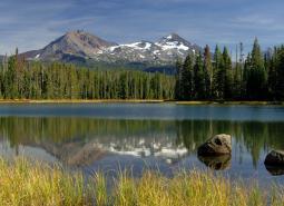
Newberry Crater [COA ID: 130]
Includes Newberry Crater and areas immediately west (accessible from Hwy 97). Nationally important geologic and recreation area. Includes Paulina Lake and East Lake.
North Fork John Day River 1 [COA ID: 168]
Located at the border of Umatilla and Grant Counties, including the town of Ukiah, significant stretches of the North Fork of the John Day River, and Camas Creek
North Fork John Day River 2 [COA ID: 169]
To the east of North Fork John Day River 1, this area encompasses high quality habitat for Strategy Species surrounding John Day Wilderness Area and near the town of Granite.
North Fork Malheur-Monument Rock Area [COA ID: 182]
At the border of Baker and Grant Counties, following the North Fork Malheur River and adjacent to Monument Rock Wilderness
North Fork Nehalem River [COA ID: 010]
The area includes the upper Nehalem River watershed to the headwaters. The area is connected to Nehalem River Estuary Nehalem COA River Estuary. It is identified by the Oregon Plan as important for native salmonids.
North Fork Siuslaw River [COA ID: 032]
A low elevation gradient river meanders to the mainstem Siuslaw river with a mixture of salt and freshwater wetlands
North Fork Smith River [COA ID: 037]
Includes a significant portion of the North Fork Smith River and surrounding upland and riparian habitat, including portions of Siuslaw National Forest
North Medford Area [COA ID: 097]
This area includes important valley bottom habitat in the Rogue Watershed including the confluence of the Rogue River and Little Butte Creek, Upper and Lower Table Rock, and Vernal Pool habitat.
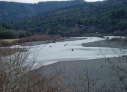
North Umpqua River Area [COA ID: 090]
Near Roseburg, area includes a significant stretch of the North Umpqua River and its tributaries, and includes surrounding riparian and upland habitats
Ochoco Mountains [COA ID: 173]
Immediately adjacent to John Day River area, at the border of Wheeler and Crook Counties
Odell Lake-Davis Lake [COA ID: 117]
Includes Davis Lake and surrounding habitat, continuing west to Salt Creek and encompassing the Crescent Lake Airport
One Horse Slough-Beaver Creek [COA ID: 083]
Area is located along the ecoregion boundary east of Albany adjacent to South Santiam River. The majority of the area is located in the One-horse slough quad
Oregon Caves-Applegate Area [COA ID: 102]
This area north of the Red Buttes Wilderness and includes the Oregon Caves National Monument. Like much of the Klamath Mountains it is home to unique plant and wildlife species with limited ranges in Oregon, including native Pacific Fisher, Siskiyou Mountain Salamanders, and Brazilian Free-tailed Bats.
Pelican Butte-Sky Lakes Area [COA ID: 123]
At the ecoregion boundary adjacent to the East Cascades, and immediately adjacent to the Upper Klamath Lake COA in the East Cascades
Pistol River Estuary [COA ID: 050]
This area contains the Pistol River Estuary, offshore rocky habitat for nesting seabirds, and Coastal Bluffs.
Powder River Sage-Grouse Core Area [COA ID: 164]
Located immediately north of Pleasant valley, adjacent to Wallowa Mountains COA, including a significant stretch of the Powder River.
Pudding River [COA ID: 068]
Area extends from the confluence with the Molalla River upstream to the Howell Prairie area located west of Mount Angel. Includes
Pueblo Mountain [COA ID: 203]
This COA encompasses the southern Oregon Pueblo Mountains from Cottonwood Creek in the north to the Monument Basin in the southwest and then east across the Pueblo Valley towards the foothills of the Trout Creek Mountains. It includes the Pueblo Mountain Wilderness Study Area; the Tum Tum Lake Research Natural Area, and the Pueblo Hills …
Quartz Mountain [COA ID: 131]
Includes significant wetland and wet meadow areas. Immediately adjacent to NB COA “Brothers – North Wagontire”.
Quartzville Creek Area [COA ID: 112]
Area includes Quartzville Creek, a major tributary of the Middle Santiam River, and is largely comprised of federally managed late-successional mixed conifer forest southwest of Mount Jefferson.
Rattlesnake Creek-Calamity Creek Area [COA ID: 181]
At the border of Grant and Harney County, area encompasses important sections of Rattlesnake Creek and Calamity Creek, immediately adjacent to the Silvies River COA
Red Prairie-Mill Creek-Willamina Oaks South [COA ID: 071]
Area is located south of Highway 19 along Highway 22 in the foothills of the Coast Range Mountains. Includes tributaries of South Yamhill River and associated lowland habitats.
Rickreall Creek and Little Luckiamute River Headwaters [COA ID: 025]
Relatively small, stand-alone COA at the border of the Coast Range ecoregion with the Willamette, just west of Falls City.
Rock Creek [COA ID: 120]
Relatively small (31 sq mi) COA encompassing an important stretch of Rock Creek. Area connects Umpqua Headwaters COA and North Umpqua COA, providing important fish and wildlife habitat connectivity.
Rock Creek-Butter Creek Grasslands [COA ID: 155]
This is the largest COA within the Columbia Plateau Ecoregion extending from Rock Creek to Butter Creek, totaling 809 square miles.
Rogue River [COA ID: 093]
This area contains habitat along the mainstem of the Rogue River including portions of the Wild and Scenic area.
Saddle Mountain [COA ID: 005]
The area contains the 3,226 acre Saddle Mountain State Park and state Natural Area, which contains the tallest mountain in Clatsop County (3,283′). Area connects with the Necanicum River watershed. Saddle Mountain is one of eight state natural areas dedicated on state managed lands.
Sage Hen Creek [COA ID: 201]
Located in the southeast corner of Lake County and the southwest corner of Harney County, this COA encompasses the southern and eastern portion of Guano Valley and continues east from Guano Rim to the foothills of Bald Mountain and Acty Mountain. It includes the Spaulding and Hawk Mountain Wilderness Study Areas and the Hawksie-Walksie Research …
Salem Hills-Ankeny NWR [COA ID: 077]
This area is comprised of the Ankeny National Wildlife Refuge, located south of Salem and the surrounding foothills.
Salmon River Estuary-Cascade Head [COA ID: 019]
This conservation opportunity area provides a unique combination of habitat types, from the rocky shoreline inland and includes the Cascade Head Scenic Research Area. At least 3 threatened and endangered species exist here including the Oregon Silverspot butterfly.
Sand Lake Area [COA ID: 015]
Relatively small (19 sq mi) area on the Oregon coast just north of Pacific City.
Santiam Confluences [COA ID: 078]
The North Santiam River Corridor that borders Linn and Marion Counties from the confluence with the Willamette River through confluences of Jefferson ditch and Valentine Creek near Stayton and the South Santiam River ‘s Confluences with Spring Branch, Thomas Creek, Spring Creek, Crabtree Creek, Onehorse Slough, and Noble Creek to Sweet Home.
Sauvie Island-Scappoose [COA ID: 054]
This area is located north of Portland and is comprised of Sauvie Island, Multnomah Channel, the Scappoose Bay area and the eastern most slopes of Forest Park along Highway 30.
Scoggins Valley-Mount Richmond [COA ID: 063]
Area is located in the foothills of the Coast Range Mountains and includes the Upper Tualatin-Scoggins Watershed, portions of the North Yamhill River and headwater tributaries, Mount Richmond, and the Oak Ridge / Moore’s Valley area.
Shady Cove Foothills [COA ID: 098]
This area contains important Oregon and California Oak Woodlands and Ceanothus Shrublands. It is
Siletz Bay [COA ID: 021]
The Siletz estuary is a diverse and complex habitat system, occupied by numerous fish and wildlife species.
Siletz River [COA ID: 022]
This Siletz River COA is a sandstone/basalt river system with variable flashy winter river flows. The surrounding forest are primarily private owned and are actively managed for wood production.
Silver Creek Area [COA ID: 175]
Located at the southern edge of the Blue Mountains Ecoregion, just west of the Silvies River. Area includes ecologically significant stretch of Silver Creek and its surrounding habitat
Siskiyou Crest Area [COA ID: 104]
This area is a long east-west running ridgline typical of the unique geology and ecology of the Klamath Mountains. It contains the head-waters for a number of stream, large mature conifers, and open alpine meadows.
Siuslaw River [COA ID: 035]
This COA stretches many miles from tidally influenced to the Willamette Valley and represents may strategy habitats.
Siuslaw River Estuary [COA ID: 034]
A rather small bay for the size of the river the COA is low elevation and low gradient with many islands and salt/freshwater marshes

Sixes River-Elk River [COA ID: 048]
This area contains much of the Coast Range’s Oak Woodlands and is potential habitat for Western Snowy Plover. It is a key corridor for migrating birds and has high plant and animal diversity.
Smith-Bybee Lakes and Columbia Slough [COA ID: 056]
Smith-Bybee Lakes is located north of Portland, adjacent to the confluence of the Willamette and Columbia Rivers. The Columbia Slough flows out of Fairview Lake north of the City of Fairview, westward through a series of regulated levees to Bybee Lake. Area includes the former St. Johns landfill.
Soda Mountain Area [COA ID: 124]
This area is a transition zone at the nexus of three ecoregions and as a results has a high diversity of species in unique assemblages.
Soldier Creek-Upper Owyhee River [COA ID: 196]
The eastern edge of this COA follows the Oregon/Idaho border from the Jordan Valley area south to the North Fork Owyhee River. It then moves west and north into the Owyhee Canyon, and includes the Spring Creek watershed and the Oregon portion of the Soldier Creek watershed. Finally, the COA covers most of Antelope Reservoir …
South Fork Coquille [COA ID: 046]
Relatively large (222 sq mi) area located within the Coast Range near the Rogue River-Siskiyou Forest and immediately adjacent to the Sixes River-Elk River COA
South Fork Crooked River Area [COA ID: 174]
At the southern edge of the ecoregion, adjacent to several COAs and slightly west of the town of Burns
South Fork Umpqua River and Tributaries [COA ID: 091]
Located in the middle of the ecoregion, this COA follows the windy course of the South Umpqua and many of its tributaries. Area boundaries near the towns of Roseburg, Winston, Dillard, Riddle, and Tiller
South John Day River [COA ID: 171]
Includes the mainstem John Day River and surrounding high quality fish and wildlife habitat. Southern part of area begins near Silvies River and continues north to the confluence near the town of Kimberly.
Sprague River [COA ID: 139]
Includes the Sprague River and its surrounding habitat.
Steens Mountain [COA ID: 192]
This COA includes much of Steens Mountain’s southwestern flank before moving north and skirting along the edge of Malheur National Wildlife Refuge and then east into the northern Steens Mountain uplands and High Lava Plains.
Summer Lake Area [COA ID: 189]
This area is comprised of Summer Lake and the surrounding high desert wetlands subregion, including much of the Diablo Mountain Wilderness Study Area.
Sutton Lake Area [COA ID: 033]
Sea Level coastal lakes with limited tidal influence and large enough to have cold water and waves
Sycan Marsh [COA ID: 136]
Includes the Sycan River, a tributary of the Sprague River with headwaters in the Fremont National Forest south of Summer Lake. Area includes surrounding areas east of Sycan Marsh.
Sycan River [COA ID: 137]
Area covers the Sycan River and surrounding area just east of Sycan Marsh
Tahkenitch-Siltcoos Lakes [COA ID: 036]
Two large coastal lakes with floating peat islands and large numbers of wintering waterfowl exist in this COA. Carnivorous pitcher plants (Darlingtonia are found along the edges.
Ten Cent Lake-Juniper Lake Area [COA ID: 193]
This COA encompasses an area south of US Highway 78 that spans Malheur and Harney Counties from the Sheepshead mountains in the east to Burnt Flat and Comegys Lake on the northern flank of Steens Mountain.
Tenmile Area [COA ID: 092]
Located west of hilly area near the town of Winston, following Highway 42
Tenmile Lake [COA ID: 040]
On the Oregon Coast near the town of Lakeside, includes North and South Tenmile Lake and surrounding habitat
Thomas Creek-Goose Lake [COA ID: 145]
Area includes Goose Lake and surrounding habitat; and Thomas Creek and its surrounding riparian habitat. Thomas Creek is the largest tributary of Goose Lake
Three Forks [COA ID: 206]
This is the most southeastern COA in Oregon and shares borders with Idaho and Nevada. It includes significant sections of the main stem Owyhee River, the Middle Fork Owyhee River, Little Owyhee River, and Toppin Creek. Its northern extent includes the three forks confluence, and its western border abuts the Little Louse Canyon COA (205) …
Tillamook Bay and Tributaries [COA ID: 011]
A large bay some 6 miles long with five rivers flowing in to it. Extensive sand/mudflats provide habitat for migratory and breeding waterfowl and shorebirds. The bay is protected from the open ocean by a the Bayocean Spit, formerly used by nesting Western Snowy Plovers.
Tillamook Head [COA ID: 003]
This area includes Ecola State Park and surrounding 9 miles of coastline between Seaside and Cannon Beach. The area includes coastal Sitka spruce forest, eventually opening up to a grassy bluff. Sea stacks punctuate the long sweep of shoreline to the south. Offshore islands provide nesting and loafing areas for several species of seabirds.
Trask Mountain [COA ID: 018]
A 37 square mile area of coast range mixed and late successional conifer forest and riparian areas of North Yamhill River wetlands. Area is conterminal with Nestucca River Watershed and Scoggins Valley-Mount Richmond COAs.
Trout Creek Mountains [COA ID: 204]
Spanning an area in the southeastern corner Harney County and southwestern Malheur County, this COA encompasses the Trout Creek Mountains, the Oregon Canyon Mountains, and the Blue Mountains. It includes numerous Wilderness Study Areas, such as Disaster Peak, Alvord Desert, Fifteenmile Creek, Mahogany Ridge, Oregon Canyon, Twelvemile Creek, and Willow Creek.
Tualatin River [COA ID: 064]
Area includes the Tualatin River and floodplain, numerous tributaries, and associated uplands from the confluence with the Willamette River upstream to Patton Valley, west of Gaston.
Umpqua Headwaters [COA ID: 119]
Located within the Umpqua National Forest and includes the headwaters of the Umpqua River.
Umpqua River [COA ID: 042]
Area follows the windy Umpqua River and surrounding riparian and upland habitat. Bounded at the north by Elkton and at the south near the towns of Melrose and Winchester
Umpqua River Estuary [COA ID: 038]
Area focuses on the Umpqua River Estuary, bounded by the coastline to the west and Highway 38 to the east
Upper Deschutes River [COA ID: 129]
Follows the Upper Deschutes River closely from the Cascade Crest.
Upper Grande Ronde River Area [COA ID: 160]
The edge of this COA includes the Starkey Experimental Forest northwest of US Highway 244 and Camp Elkanah; and Starkey to the east before spreading south and encompassing the Fly Creek and upper Grande Ronde River watersheds.
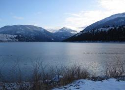
Upper Klamath Lake Area [COA ID: 138]
Includes Upper Klamath Lake, the largest freshwater lake west of the Rocky Mountains. Area includes surrounding habitat to the north and adjacent to the Sky Lakes area
Upper Silvies River [COA ID: 178]
Includes significant stretch of the Silvies River and surrounding habitat. Spans Blue Mountains (bounded at the north by the town of Seneca) and Northern Basin & Range Ecoregion (starting at Malheur Lake to the south), passing through the town of Burns
Upper Siuslaw [COA ID: 089]
Follows the windy Siuslaw River and surrounding habitat. Area builds from the Siuslaw Estuary COA to the west and extends east towards Cottage Grove.
Upper South Fork Malheur Area [COA ID: 188]
This COA straddles US Highway 78 southeast of Malheur Lake and provides connectivity between the Crowley (185) COA, Ten Cent Lake-Juniper Lake Area (193) COA, and the Steens Mountain High Lava Plains (192) COA. North of US Highway 78 the COA includes Malheur Cave and a section of South Fork Malheur River. South of 78 …
Upper Willamette River Floodplain [COA ID: 061]
This area includes the Willamette River floodplain from South of Springfield in the Dexter/Lowell area north to Albany.
Walla Walla Headwaters [COA ID: 157]
This COA is mainly located within the Blue Mountains ecoregion of Umatilla, Union, and Wallowa Counties, but enters into a small section of the Columbia Plateau ecoregion along its northwest corner. Characterized by extensive mixed conifer forest, this rugged landscape also contains important native perennial grasslands, abundant springs, and abuts the North Fork Umatilla Wilderness …
Wallowa Mountains [COA ID: 163]
Located in northeastern Oregon adjacent to the Wallowa-Whitman National Forest.
Warm Springs River [COA ID: 126]
Area includes the Warm Springs River (a tributary to the Deschutes River) and surrounding habitat. River flows eastward with headwaters in the Cascade Crest
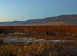
Warner Basin Wetlands [COA ID: 199]
Encompassing Warner Valley and associated wetlands, this COA stretches from just above Blue Joint Lake in the north to the Oregon/Nevada border in the south, and includes the Rahilly-Gravelly Research Natural Area, the Fish Creek Rim Research Natural Area, and the Warner Wetlands Area Of Critical Environmental Concern.
Warner Mountains [COA ID: 146]
Area located east of Lakeview along the eastern border of the ecoregion
Warner West [COA ID: 198]
This COA includes portion of Abert Rim Wilderness Study Area, Fish Creek Rim Wilderness Study Area, Lake Abert Area of Critical Environmental Concern, and the Fish Creek Rim Research Natural Area. It encompasses an area between Abert Rim and the Warner Mountains on the western edge to South Warner Rim and Lynches Rim to the …
Wasco Oaks [COA ID: 125]
Area extends from the Columbia River up through the Mt. Hood National Forest and has served as an important emphasis for conservation and restoration efforts.
Wassen Creek [COA ID: 039]
Connects to the northern portion of Umpqua River Estuary. Focuses on Wassen Creek and surrounding upland and riparian habitats. Includes some Siuslaw National Forest land
West Eugene Area [COA ID: 086]
This site extends from Camas Swale north along the foothills to Cox Butte, including the West Eugene wetlands
Whychus Creek [COA ID: 128]
Willow Creek-Birch Creek Area [COA ID: 167]
Located between the towns of Brogan and Huntington, at the eastern border of the ecoregion adjacent to the Snake River
Yachats River Area [COA ID: 030]
A narrow river channel with a wide shallow mouth at the ocean, this COA incorporates steep coastal mountains.
Yamhill Oaks-Willamina Oaks North [COA ID: 067]
Area is located west of McMinnville in the foothills of the Coast Range Mountains and within the South Yamhill River Watershed.
Yaquina Bay [COA ID: 026]
The Yaquina estuary COA is a large watershed with numerous fish, wildlife, habitat, and human resources.
Zumwalt Prairie Plateau [COA ID: 162]
At the eastern edge of the ecoregion northeast of Enterprise and Joseph, the area builds from TNC Zumwalt Prairie and extends northwest to include significant canyon and riparian habitat