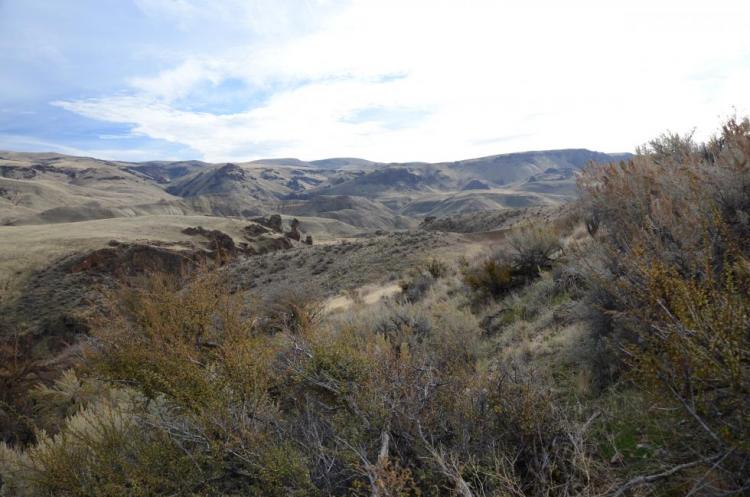
This COA is located in the northeast quarter of Malheur County and abuts the Crowley COA to the west. It encompasses Owyhee Lake and River from just east of Mitchell Butte (near the city of Adrian) south to Greeley Bar. Continuing south and east, the COA includes the rugged landscape of Mahogany Mountain, Jordan Craters, Spring Mountain, and Table Mountain as well as the Cow Lakes before ending at the Lava Bends and Jorden Creek at its southern terminus.
COA ID: 186
Ecoregions
Strategy Habitats
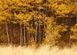
Aspen Woodlands
Aspen woodlands are woodland or forest communities, dominated by aspen trees with a forb, grass, or shrub understory. Aspen woodlands can also occur within conifer forests.
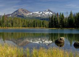
Natural Lakes
Natural lakes are relatively large bodies of freshwater surrounded by land. For the purposes of the Conservation Strategy, natural lakes are defined as standing water bodies larger than 20 acres, including some seasonal lakes.
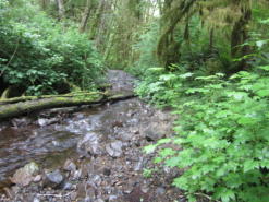
Flowing Water and Riparian Habitats
Flowing Water and Riparian Habitats include all naturally occurring flowing freshwater streams and rivers throughout Oregon as well as the adjacent riparian habitat.
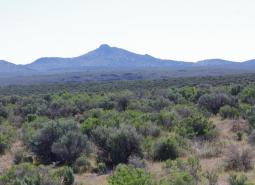
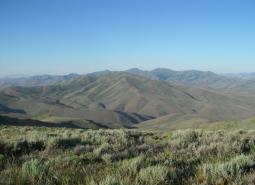
Sagebrush Habitats
Sagebrush habitats include all sagebrush steppe- and shrubland-dominated communities found east of the Cascade Mountains.
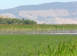
Wetlands
Wetlands are covered with water during all or part of the year. Permanently wet habitats include backwater sloughs, oxbow lakes, and marshes, while seasonally wet habitats include seasonal ponds, vernal pools, and wet prairies.
Strategy Species
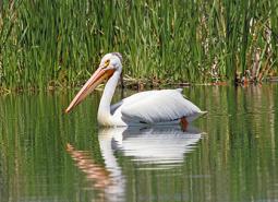
American White Pelican (Observed)
Pelecanus erythrorhynchos
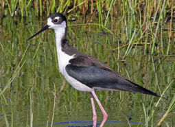
Black-necked Stilt (Observed)
Himantopus mexicanus
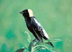
Bobolink (Observed)
Dolichonyx oryzivorus
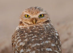
Burrowing Owl (Observed)
Athene cunicularia hypugaea
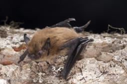
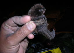
California Myotis (Observed)
Myotis californicus
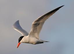
Caspian Tern (Observed)
Hydroprogne caspia
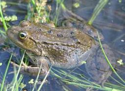
Columbia Spotted Frog (Observed)
Rana luteiventris
Cronquist’s Stickseed (Observed)
Hackelia cronquistii
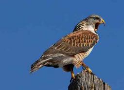
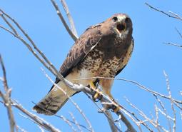
Ferruginous Hawk (Observed)
Buteo regalis
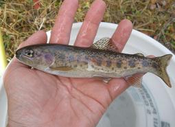
Great Basin Redband Trout (Documented)
Oncorhynchus mykiss newberrii
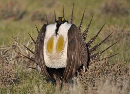
Greater Sage-Grouse (Observed)
Centrocercus urophasianus
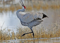
Greater Sandhill Crane (Observed)
Antigone canadensis tabida
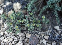
Grimy Ivesia (Observed)
Ivesia rhypara var. rhypara
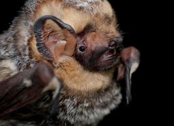
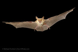
Hoary Bat (Modeled Habitat)
Lasiurus cinereus
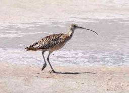
Long-billed Curlew (Observed)
Numenius americanus
Long-legged Myotis (Modeled Habitat)
Myotis volans
Mountain Quail (Modeled Habitat)
Oreortyx pictus
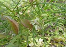
Mulford’s Milkvetch (Observed)
Astragalus mulfordiae
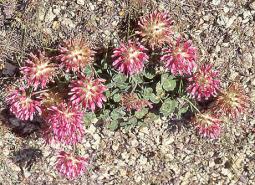
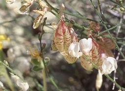
Owyhee Clover (Observed)
Trifolium owyheense
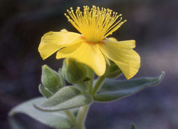
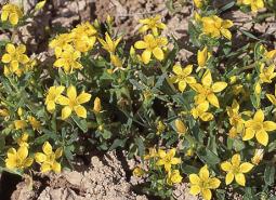
Packard’s Mentzelia (Observed)
Mentzelia packardiae
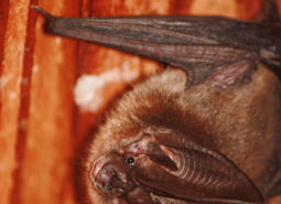
Pallid Bat (Observed)
Antrozous pallidus
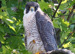
Peregrine Falcon (Observed)
Falco peregrinus anatum
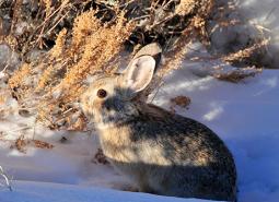
Pygmy Rabbit (Observed)
Brachylagus idahoensis
Silver-haired Bat (Observed)
Lasionycteris noctivagans
Smooth Mentzelia (Observed)
Mentzelia mollis
Spotted Bat (Observed)
Euderma maculatum
Sterile Milkvetch (Observed)
Astragalus cusickii var. sterilis
Swainson’s Hawk (Observed)
Buteo swainsoni
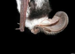
Townsend’s Big-eared Bat (Observed)
Corynorhinus townsendii
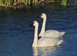
Trumpeter Swan (Observed)
Cygnus buccinator
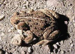
Western Toad (Observed)
Anaxyrus boreas
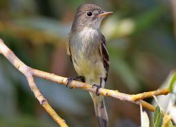
Willow Flycatcher (Observed)
Empidonax traillii