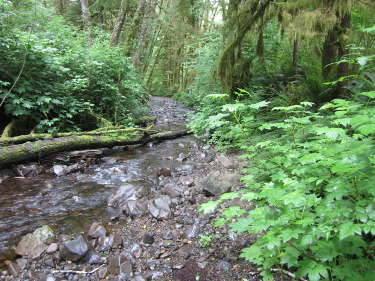
Flowing Water and Riparian Habitats include all naturally occurring flowing freshwater streams and rivers throughout Oregon as well as the adjacent riparian habitat.
Limiting Factors and Recommended Approaches
Limiting Factor: Water Quantity
Water availability is limited in some parts of the state, and concern increases under a changing climate. Low flows are associated with higher water temperature and higher nutrient and contaminant concentrations. Riparian bottomland habitats compete for water with other uses, particularly in the Blue Mountains, Columbia Plateau, East Cascades, and Northern Basin and Range ecoregions. In eastern Oregon, agriculture consumes much of the available water. Diversions occur at all major streams, and most valley bottoms have multiple canals that divert water. As a result, riparian habitats no longer support the many channels and sinuosity that are characteristic of healthy stream systems.
Recommended Approach
Where possible, maintain flow following the natural hydrological cycle. Improve irrigation efficiency. Lease water for instream use. In cooperative voluntary approaches that allow for purchase of instream water rights, prioritize use for agricultural purposes providing the greatest economic benefit. Maintaining streamflow and water storage is especially important to riparian conservation in eastern Oregon ecoregions. Provide incentives and information about water usage and sharing at key times of low flow conditions (e.g., late summer).
Limiting Factor: Invasive Aquatic Species
Invasive fish species (e.g., bass, crappie, bluegill, yellow perch, bullhead, carp) can compete with, prey on, or hybridize with native fish (e.g., steelhead, rainbow trout) and amphibians. For example, in the Columbia Basin, non-native carp can overgraze aquatic vegetation and stir up sediment, depriving native fish and amphibians of egg-laying sites or preventing eggs from absorbing enough oxygen to develop. Alterations in hydrology can make the habitat more susceptible to invasive plants, invertebrates, and fish.
Recommended Approach
Restoration of aquatic habitats to conditions that support native fish and wildlife is the best strategy to prevent invasive species. Maintaining historical hydrological regimes ensures that habitat conditions best support native fish and wildlife. Work with community partners to restore flow and water input levels. Where necessary, work to minimize predation on sensitive native species. Where non-native aquatic species threaten Strategy Species, consider site-appropriate tools (e.g., mechanical or chemical treatment) in locations and during seasons where they will not harm native amphibians, fish, or invertebrates. Educate and inform people about the problems that can be caused by invasive species.
Limiting Factor: Passage Barriers and Channel Complexity
Fish and wildlife depend on natural flow regimes and substrates for breeding, foraging, cover, and migration. Dams, road culverts, or log puncheons can alter or affect in-stream flow. The large dams on almost all of the Cascade rivers disrupt natural hydrologic regimes, which decreases the amount of bottomland habitat, and impacts anadromous fish passage upstream and downstream. Misaligned culverts with the downstream end above the water level disconnect stream passage corridors and may force wildlife to cross roads where they are vulnerable to vehicles and predators. Undersized or improperly sized culverts can alter the transport of sediment and wood, creating an uneven distribution of habitat. These effects can degrade riparian habitat and impact riparian-associated fish and wildlife. Additionally, altered flow regimes can contribute to higher temperatures in some streams. Channel complexity is also important for fish and wildlife. Woody debris and other structures provide nutrient cycling and refugia from predators and high temperatures.
Recommended Approach
Where possible, work with landowners and regulatory agencies to restore natural flow conditions on streams impacted by barriers. Eliminate passage barriers or improve passage at existing barriers to provide travel corridors for fish and wildlife. Remove or replace culverts or other passage barriers with structures that mimic natural conditions as closely as possible (e.g., bridges or open-bottom arch culverts). Determine potential effectiveness of providing passage around dams for fish and wildlife (e.g., amphibians, reptiles, mammals). Develop new habitat sites where possible. Provide sufficient channel complexity to maintain ecological benefits for fish and wildlife. Support and encourage beaver dam-building activity.
Limiting Factor: Pollution
Non-point source pollution sometimes contains fertilizers, pesticides, or oil-based pollutants at levels high enough to cause significant lethal or sub-lethal effects in native fish and wildlife. Point source pollution from industrial practices can contain high levels of contaminants. Point and non-point source pollution are both of particular concern in more highly populated regions. In some areas, particularly the Rogue River and its tributaries, increasing use of recreational motor vehicles (e.g., jet boats) has the potential to degrade water quality with runoff, or to harass aquatic or riparian-associated wildlife.
Recommended Approach
Increase awareness of the impacts of urban runoff and pesticide applications. Increase awareness and manage timing of applications of potential aquatic contaminants. Improve compliance with water quality standards and pesticide use labels administered by the DEQ and U.S. Environmental Protection Agency (EPA). Work on implementing Senate Bill 1010 (ODA) and DEQ Total Maximum Daily Load water quality plans. Carefully consider recreational vehicle use and timing on sensitive or “wild and scenic” water bodies. Increase interaction of rivers and floodplains. Encourage opportunities for restoration of “fringe” wetlands and channel meander to increase water storage. Reduce stormwater runoff and increase permeability in urban areas, allowing more water to seep into the ground. Use stormwater catchment basins designed for larger volume, longer residence, and a high degree of shading to mimic the delay, treatment, infiltration, and cooling functions of natural wetlands. During restoration, remove pipes and provide stream channels to promote flow, nutrient, and oxygen exchange. Where possible, provide sufficient room to restore meanders and other functions.
Limiting Factor: Water Temperature
Aquatic animals have specific requirements for a tolerable temperature range. Moreover, warmer water holds less dissolved oxygen. Water temperature often is too warm for native aquatic life because of alterations in stream flow, thermal pollution, or reduced riparian shading. Recommending optimal water temperatures is difficult because of a lack of understanding about historical temperature regimes.
Recommended Approach
Maintain or increase riparian habitat cover to provide shading and other benefits. Where appropriate, revegetate degraded riparian areas. Minimize release of unnaturally warm water in the fall and summer by altering intake/release structures. Maintain and restore in-stream flow to help preserve favorable water temperatures. (KCI: Water Quality and Quantity)
Limiting Factor: Sedimentation
Sediment flows into streams from various human activities, as well as natural processes, covering eggs of native fish and amphibians, making them more susceptible to infection, and potentially burying aquatic mollusks and freshwater mussels.
Recommended Approach
Reduce run-off of sediment from logging, agriculture, grazing, roads, and other activities that could disturb soil or destabilize streambanks. For example, work with the ODA to promote implementation of area-wide water quality management plans under Senate Bill 1010 so that farmers and ranchers know which actions they can implement to address water quality problems in their watershed. Strategies include terracing fields, filtering run-off before it enters aquatic systems, installing sediment control basins to reduce erosion, and practicing conservation tillage. Water quality credit trading programs to control sediment loads (and other pollutants) can help to ensure good water quality levels. When constructing new roads, consider sediment removal capabilities in road design. Maintain and restore riparian and wetland vegetation to filter sediments.
Limiting Factor: Loss of Riparian Habitat, Floodplain Function, and Habitat Complexity
A high percentage of low-elevation and valley bottom riparian habitats have been altered or lost. Riparian vegetation often is lost as habitat is converted to other uses. In several areas around the state, large cottonwood trees and gallery forest have been cleared and diked, leading to altered hydrological regimes and other impacts. Development within historical floodplains can restrict the natural ability of streams and riparian habitats to meander, limiting the creation and maintenance of new aquatic and riparian habitats. In some cases, floodplains have been converted to other uses, and riparian habitats no longer exist. Non-adherence to best management practices, such as removal of riparian vegetation, can cause sedimentation that damages aquatic areas, loss of habitat complexity, and increased water temperatures that adversely affect aquatic habitat. Loss of streamside vegetation leads to bank erosion. Grazing and dam construction can degrade riparian habitats. Urban development has led to stream channelization and vegetation loss in some areas. Losses of riparian complexity and connectivity limit the value of these important places for wildlife to meet crucial life history needs.
Recommended Approach
Restore riparian zones that will provide the full array of associated ecological functions. Enhance or re-establish the extent and connectivity of existing riparian habitats. Use voluntary cooperative efforts (i.e., Conservation Reserve Enhancement Program) and incentive programs to conserve, maintain, and restore riparian habitats on private lands. Identify and apply lessons learned from successful riparian restoration efforts on private lands to future projects. Develop tools and financial incentives to assist with streambank stabilization and decrease downstream soil movement. Improvements in riparian habitats and hydrology can also improve the quality of remaining wetland habitats. Maintain and restore riparian buffers, and minimize impacts from road-building on public lands. Where appropriate, allow beavers to continue maintaining habitat complexity, particularly in the Coast Range and parts of eastern Oregon. Maintain channel integrity and natural hydrology. Where feasible, work to restore historical hydrological conditions. Ensure that adequate riparian vegetation remains following management activities, so riparian vegetation can continue to prevent erosion, preserve water quality, and promote water temperatures favorable for fish. Restore lost vegetation through planting of native trees, shrubs, and ground cover. Manage for future sources of large woody debris. Maintain and/or expand existing tracts of large trees. For example, cottonwood trees greater than 20 inches in diameter offer benefits to riparian habitat function.
Limiting Factor: Riparian Habitat Degradation
In the Blue Mountains, Northern Basin and Range, East Cascades, and Columbia Plateau ecoregions, historical overgrazing has led to soil erosion, poor regeneration of hardwood trees and shrubs, changes in plant species composition and structure, and degradation by invasive plants. Although some areas are slowly recovering, many miles of stream are still lacking adequate riparian vegetation. Ongoing grazing impacts remain in some areas, especially at low and mid elevations. Western juniper is encroaching in some riparian areas of eastern Oregon.
Recommended Approach
In cooperation with landowners, land managers, and grazing lessees, encourage approaches such as off-site watering that keep livestock out of riparian areas. Develop and implement grazing regimes that are compatible with riparian conservation objectives. Selectively fence restoration sites or other high priority areas to exclude ungulates, at least until riparian vegetation recovers. Evaluate impacts by encroaching western juniper, and remove juniper from upper reaches of higher elevation watersheds, if appropriate. Plant riparian vegetation using native species at priority sites. Continue to work with landowners and grazing permittees to support riparian conservation and land management objectives.
Limiting Factor: Invasive Plants in Riparian Habitat
Invasive plants, such as knapweeds, knotweeds, reed canary grass, and thistles, degrade riparian habitats by competing with native plants. In the Columbia Plateau and Northern Basin and Range ecoregions, pasture grasses and cheatgrass commonly dominate the understory. In some riparian areas in the Northern Basin and Range, Columbia Plateau, and East Cascades ecoregions, overgrazing has resulted in poor regeneration of hardwood trees and shrubs.
Recommended Approach
Control key invasive plants using site-appropriate tools, including mechanical, biological, and chemical treatments. Use chemical treatments carefully and where compatible with water quality concerns, focusing on spot treatment during the dry season. In the Columbia Plateau and Northern Basin and Range ecoregions, focus control at low-elevation sites, unless near streams where seeds could flow downstream. Provide information to local governments and landowners about potential invasive plants. Where necessary (e.g., some areas in the Northern Basin and Range, East Cascades, and Columbia Plateau ecoregions), develop and implement grazing management regimes that are compatible with riparian conservation objectives.