Project Summary
The Oregon Connectivity Assessment and Mapping Project (OCAMP) was a multi-year, collaborative effort to analyze and map statewide wildlife habitat connectivity for Oregon’s wildlife. There has been a critical need to develop connectivity maps for a broad array of Oregon’s wildlife species. Many species rely on the ability to move throughout the landscape to fulfill their daily and seasonal needs for access to food, shelter, and opportunities to reproduce. Human changes to the landscape often restrict the ability of wildlife to move by adding barriers, inducing changes in their behavior, impacting critical migration stopover sites, and increasing habitat fragmentation. Mapping and maintaining habitat important for movement helps protect population connectivity and biodiversity, aiding in the restoration of at-risk species. Providing and conserving habitat connectivity is also a key management strategy to preserve species and ecosystem processes under a changing climate. Historically, efforts to map connected habitat in Oregon were primarily based on expert opinion that insufficiently supported decision-making regarding species’ mobility and habitat connectivity needs.
The OCAMP effort focused on identifying current wildlife habitat connectivity throughout the state for a wide diversity of species. Fifty-four species were selected for the project as surrogates, representing a variety of taxa, movement types, dispersal capabilities, and sensitivity to anthropogenic threats. These species’ connectivity models were compiled to highlight Priority Wildlife Connectivity Areas (PWCAs)– an interconnected network representing the parts of the landscape with the highest overall value for facilitating wildlife movement in Oregon. The PWCAs, as well as other maps and models produced during OCAMP, will aid in statewide planning and prioritization efforts to maintain functional habitat connectivity; help direct on-the-ground efforts for acquisition, restoration, and conservation of habitat for fish and wildlife; inform long-term planning documents for managed lands; guide granting efforts; inform land use development, including expansion of urban growth boundaries, permitting for renewable energy development, and development of sensitive habitats; and aid in mitigating transportation issues, such as identifying areas where wildlife passage structures could best reduce wildlife-vehicle collisions.
If you’d like to learn more about the methods applied in developing Priority Wildlife Connectivity Areas, the recording of the Winter 2023 meeting of the OCAMP Stakeholder Committee, below, provides a comprehensive project review. You can find more information about PWCAs here.

species
OCAMP species were selected using a collaborative process informed by species biologists and conservation practitioners across the state. All modeling occurred across each species’ range. While species were selected to represent specific habitat associations and/or structural habitat characteristics, each species utilizes multiple habitat types, and this is reflected in the habitat and connectivity models.
Species Selected for OCAMP
| Species | Strategy Species? | Taxa | Selected to Represent | Associated Structural Habitat Characteristic(s) | Species Range (by Ecoregion) |
|---|---|---|---|---|---|
| American Beaver | No | Mammal | Wetlands | Woody streamside vegetation | CR, WV, KM, WC, EC, CP, BM, NBR |
| American Pika | Yes | Mammal | Alpine Grasslands and Shrublands/Subalpine Parkland | Broken talus | WC, EC, BM, NBR |
| Bighorn Sheep | Yes (Rocky Mountain Subspecies) | Mammal | Dwarf Shrub-steppe | Alpine meadows and rocky slopes | EC, CP, BM, NBR |
| Black-tailed Deer | No | Mammal | Habitat Generalist | CR, WV, KM, WC, EC | |
| Black-tailed Jackrabbit | No | Mammal | Shrub-steppe | WV, KM, EC, CP, BM, NBR | |
| Burrowing Owl | Yes | Bird | Shrub-steppe | Low, sparse vegetation | CP, BM, NBR |
| Bushy-tailed Woodrat | No | Mammal | Conifer-Hardwood Forests | Rocky outcrops | CR, WV, KM, WC, EC, CP, BM, NBR |
| Cascades Frog | Yes | Amphibian | Alpine Grasslands and Shrublands/Subalpine Parkland | WC, EC | |
| Coastal Tailed Frog | Yes | Amphibian | Montane Mixed Conifer Forest | Headwater streams | CR, KM, WC, EC |
| Columbia Spotted Frog | Yes | Amphibian | Open Water | BM, NBR | |
| Cougar | No | Mammal | Habitat Generalist | CR, WV, KM, WC, EC, CP, BM, NBR | |
| Fender's Blue Butterfly | Yes | Invertebrate | Grasslands | Floral resources | WV |
| Ferruginous Hawk | Yes | Bird | Shrub-steppe/Dwarf Shrub-steppe | EC, CP, BM, NBR | |
| Fisher | Yes | Mammal | Montane Mixed Conifer Forest | Require large-diameter snags/cavity trees for denning | CR, KM, WC |
| Foothill Yellow-legged Frog | Yes | Amphibian | Southwest Oregon Mixed Conifer-Hardwood Forest | CR, KM, WC | |
| Great Gray Owl | Yes | Bird | Eastside (Interior) Mixed Conifer Forest | Montane meadows | KM, WC, EC, BM |
| Greater Sage-grouse | Yes | Bird | Shrub-steppe | EC, BM, NBR | |
| Hermit Thrush | No | Bird | Southwest Oregon Mixed Conifer-Hardwood Forest | CR, KM, WC, EC, BM | |
| Hoary Bat | Yes | Mammal | Eastside (Interior) Riparian-Wetlands | CR, WV, KM, WC, EC, CP, BM, NBR | |
| Lazuli Bunting | No | Bird | Eastside (Interior) Riparian Wetlands | CR, WV, KM, WC, EC, CP, BM, NBR | |
| Lewis's Woodpecker | Yes | Bird | Westside Oak and Dry Douglas-fir Forest and Woodlands | Snags | KM, WC, EC, CP, BM, NBR |
| Little Brown Myotis | No | Mammal | Ponderosa Pine Woodlands | CR, WV, KM, WC, EC, CP, BM, NBR | |
| Long-nosed Leopard Lizard | No | Reptile | Desert Playa and Salt Scrub Shrublands | Scattered, sparse vegetation; sandy/gravel substrate | NBR |
| Long-toed Salamander | No | Amphibian | Herbaceous Wetlands | CR, WV, KM, WC, EC, CP, BM, NBR | |
| Marten | Yes | Mammal | Late Successional Mixed Conifer Forests | Associated with salal layer on coast | CR, KM, WC, EC, BM |
| Morrison's Bumble Bee | No | Invertebrate | Shrub-steppe | Floral resources | EC, NBR |
| Mountain Goat | No | Mammal | Alpine Grasslands and Shrublands/Subalpine Parkland | BM | |
| Mule Deer | No | Mammal | Habitat Generalist | EC, CP, BM, NBR | |
| North American Porcupine | No | Mammal | Aspen Woodlands | CR, WV, KM, WC, EC, CP, BM, NBR | |
| Northern Alligator Lizard | No | Reptile | Ceanothus-Manzanita Shrublands | Downed woody debris; rock piles | CR, WV, KM, WC |
| Northern Flying Squirrel | No | Mammal | Late Successional Mixed Conifer Forests | Interconnected canopies | CR, WV, KM, WC, EC, BM |
| Northern Red-legged Frog | Yes | Amphibian | Late Successional Mixed Conifer Forests | Aquatic-terrestrial linkage | CR, WV, KM, WC |
| Ord's Kangaroo Rat | No | Mammal | Shrub-steppe | CP, BM, NBR | |
| Oregon Slender Salamander | Yes | Amphibian | Westside Riparian Wetlands | Late-seral forests | WC |
| Pacific-slope Flycatcher | No | Bird | Late Successional Mixed Conifer Forests | Complex canopy layers | CR, WV, KM, WC, EC |
| Pileated Woodpecker | Yes | Bird | Southwest Oregon Mixed Conifer-Hardwood Forest | Snags | CR, WV, KM, WC, EC, BM |
| Pronghorn | No | Mammal | Shrub-steppe | EC, CP, BM, NBR | |
| Purple Martin | Yes | Bird | Westside Lowlands Conifer-Hardwood Forest | Early seral habitats; snags | CR, WV, KM, WC |
| Pygmy Rabbit | Yes | Mammal | Shrub-steppe | EC, BM, NBR | |
| Red-naped Sapsucker | No | Bird | Aspen Woodlands | WC, EC, CP, BM, NBR | |
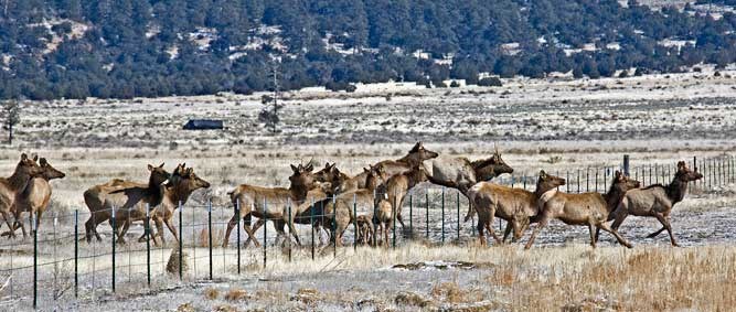
| Rocky Mountain Elk | No | Mammal | Habitat Generalist | EC, CP, BM, NBR | |
| Roosevelt Elk | No | Mammal | Habitat Generalist | Use clear-cuts/ag lands | CR, WV, KM, WC, EC |
| Sierra Nevada Red Fox | Yes | Mammal | Montane Mixed Conifer Forest | WC, EC | |
| Slender-billed White-breasted Nuthatch | Yes | Bird | Oak Woodlands | WV, KM, EC, BM | |
| Townsend's Chipmunk | No | Mammal | Conifer-Hardwood Forests | Use clear-cuts | CR, WV, KM, WC, EC |
| Vesper Sparrow | Yes | Bird | Eastside (Interior) Grasslands | WV, KM, EC, CP, BM, NBR | |
| Western Bumble Bee | Yes | Invertebrate | Mixed Woodlands | Floral resources | WC, EC |
| Western Gray Squirrel | Yes | Mammal | Westside Lowlands Conifer-Hardwood Forest | CR, WV, KM, WC, EC | |
| Western Meadowlark | Yes | Bird | Eastside (Interior) Grasslands | WV, KM, EC, CP, BM, NBR | |
| Western Pond Turtle | Yes | Reptile | Open Water | CR, WV, KM, WC, EC | |
| Western Rattlesnake | Yes | Reptile | Westside Lowlands Conifer-Hardwood Forest | CR, WV, KM, WC, EC, CP, BM, NBR | |
| Western Snowy Plover | Yes | Bird | Coastal Dunes | CR, NBR | |
| Western Toad | Yes | Amphibian | Montane Coniferous Wetlands | CR, KM, WC, EC, CP, BM, NBR | |
| Wrentit | No | Bird | Oak Woodlands | Dense shrub layers | CR, KM, WC |

upcoming events
OCAMP is complete!
You can view the Priority Wildlife Connectivity Areas (PWCAs) here.
Access more information about PWCAs, review project methods, and download reports and data here.

